§ 01
PROBLEM
What it had to solve.
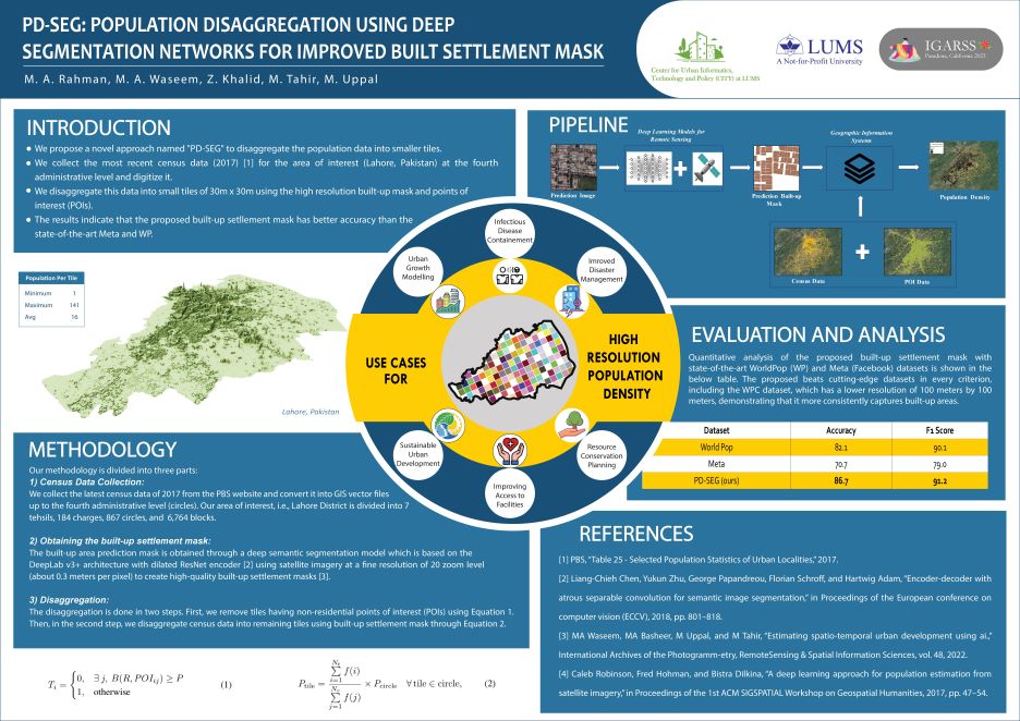
Census data comes at coarse admin-unit level. For humanitarian planning — vaccine distribution, disaster response — you need pixel-level estimates, especially in informal settlements that grid-based baselines miss.
§ 02
APPROACH
How it works.
PD-SEG treats building footprints as a structural prior, feeding a segmentation head that predicts per-pixel population given district-level totals. Trained end-to-end with a constraint that district sums match census.
§ 03
RESULTS
What it delivered.
Beat WorldPop by 18% RMSE and Meta HRSL by 11% on held-out districts, with gains concentrated in informal settlements.