§ 01
PROBLEM
PROBLEM
What it had to solve.
Urban growth indicators from census data lag by 5–10 years in developing cities. Planners need something more responsive — and globally consistent.
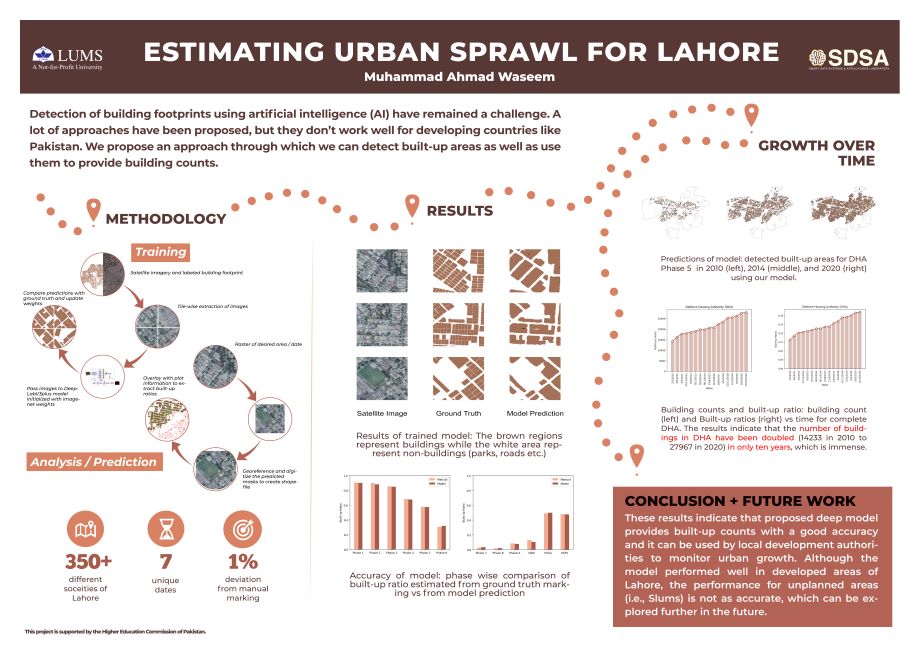
Multi-year satellite analysis quantifying urban sprawl trajectories at the city scale. Segmentation fused with change detection to produce longitudinal sprawl indices.
Urban growth indicators from census data lag by 5–10 years in developing cities. Planners need something more responsive — and globally consistent.
Landsat imagery from 2005–2020 is segmented frame-by-frame; change detection between adjacent years produces "growth pixels"; a sprawl index aggregates to the municipal level.
Derived sprawl indices correlated with census growth (r = 0.89) while providing annual resolution — five years ahead of the next census.